


Historical GIS Database on the Songjiang Region in Late Ming China
Output of Project on Cotton Textile Industry in Songjiangfu Region during the Late Ming Period
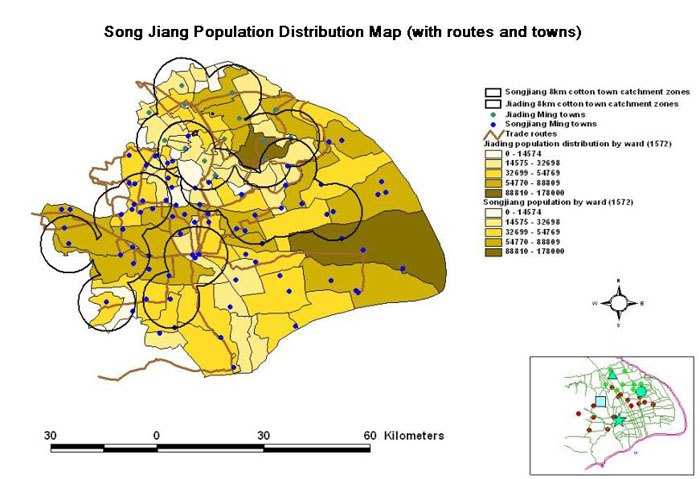
This project deals with the region of Ming Songjiangfu and Ming Jiading county in the Lower Yangzi delta, roughly equivalent to the modern Shanghai Municipality, in the late sixteenth and early seventeenth centuries. This region was the major cotton textile production area of late imperial China.
There are three major objectives for this project:
- To construct a micro database of Historical Geographic Information System (GIS) on the spatial structure of this industry;
- To reinterpret the economic performance of this cotton economy in the light of based on the newly constructed GIS database.
- To explore the institutional matrix of the cotton industry in the late Ming Songjiangfu;
In sum, this is a multidisciplinary study combining socioeconomic history, local history, GIS, regional analysis, and new institutional economics with a view to generating new understanding of and research strategies towards China’s economic development past and present.
For details, please click this link:
http://www.iseis.cuhk.edu.hk/songjiang