


Web-based VR Tool
A tool called GeoVR has been designed and developed under a client/server architecture to enable the interactive creation of 3D scene and Virtual Reality Modeling Language (VRML) model from 2D spatial data by integrating Internet Geographical Information System (GIS) and HTML programming.
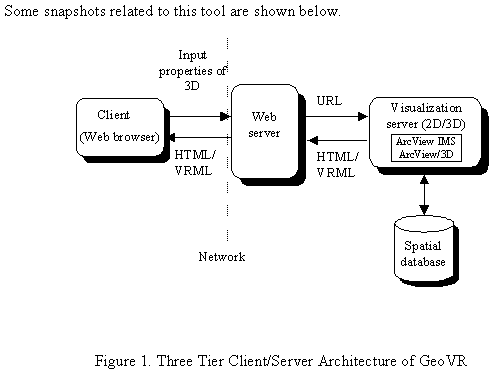
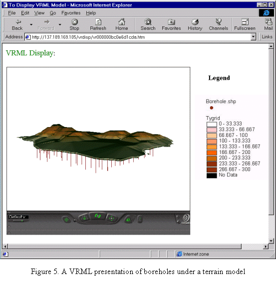
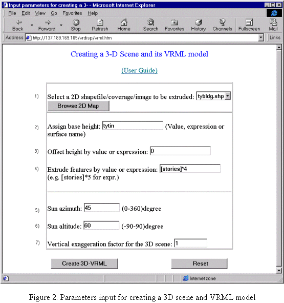
The client front-end of this tool provides a HTML form to set properties for building 3D scenes, while the server back-end supported by off-the-shelf software: ArcView Internet Map Server and ArcView 3D analyst through Avenue programming, processes the parameters and generates a 3D scene. This 3D scene is then transformed into a VRML model, which, together with its legend, is sent back to the VRML-enabled WWW browser for display and navigation.
It is demonstrated that this tool, not only automates the conversion of the conventional 2D GIS data into VRML, but also adapts the current GIS 3D capabilities to the increasingly popular Web environment. The development of such a tool offers new opportunities for users to build applications that benefit from virtual reality presentation based upon the existing GIS spatial databases.