Aug 4, 2007
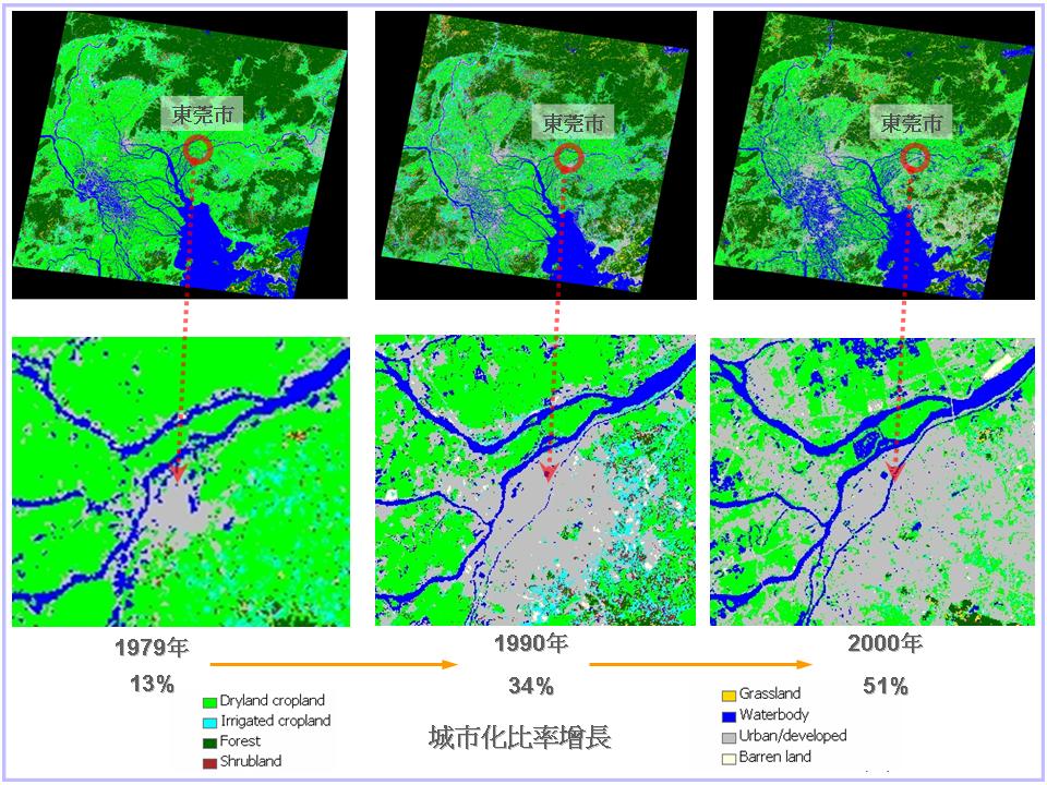
Pearl River Delta Environmental survey
Aug 3, 2007

Monitor oil spill by ENVISAT ASAR image
Jul 20, 2007

ENVISAT ASAR image on July 20 showing part of Anhui Province's flooding situation
Jul 10, 2007

ENVISAT ASAR image on June 28 2007 showed the area of Shanghai, SuZhou and TaiHu, etcˇK
Nov 26, 2006
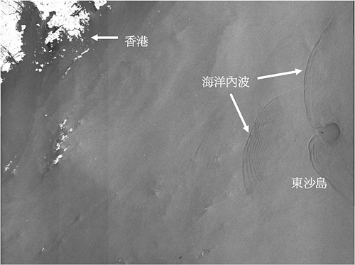
On 20 November, 2006, gorund station received a satellite image about Nan Hai's internal wave. From the image, we can notice the accurate location. The location is around Dong Sha Island, where is about 300 kilometers distant from Hong Kong.
Nov 24, 2006

[Mingpao News] The biggest ever hillfire in the last decade in Hong Kong has blazed large area of forest in Tai Lam Country Park. Satellite images captured by the Yuen Yuen Research Centre for Satellite Remote Sensing of The Chinese University of Hong Kong in collaboration with Taiwan University indicate that this recent hillfire has destroyed almost 740 hectares of tree.
Nov 21, 2006

[Mingpao News] Dongting Lake, the second largest freshwater lake, is drying up rapidly due to impact of durative drought in the past a few months. From July to October in this year, four satellite images over Dongting Lake were received by the CUHK Satellite Remote Sensing Receiving Station. By comparing images of July and October, we can see clearly the large-area drying up in Dongting Lake region.
Mar 17, 2006
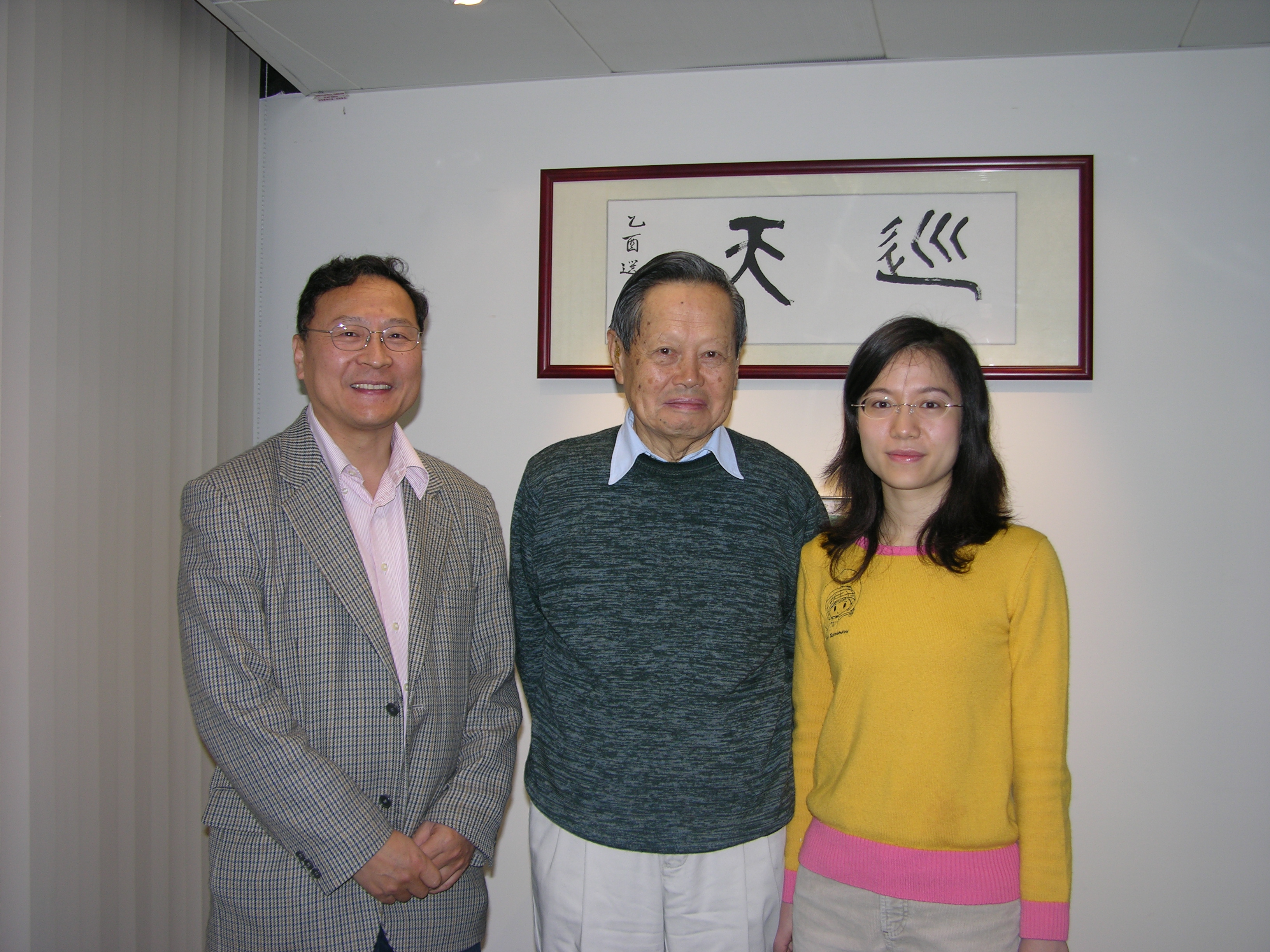
Nobelist Yang Chen Ning visit JLGIS
Nov 28, 2005

"Shenzhou 6 capsule" two astronants, Nie Haisheng and Fei Junlong, visited JLGIS.
Oct 5, 2005

Inauguration of the First Phase of the Satellite Remote Sensing Receiving Station and the Institute of the Space and Earth Information Science of The Chinese University of Hong Kong