Prof. Yang Hongfeng Takes the Pulse of Earthquakes in Indian Ocean

Despite technological advancement, humans are often powerless in the face of natural disasters. Earthquakes often come unpredicted and are still a threat in modern world, as the Sichuan quake in 2008, the Northeast Japan quake in 2011, and Taiwan’s Hualien quake in February well attested. Some scientists spend their lifetime researching into the natural disasters in the hope of finding ways to reduce the loss from earthquakes and tsunamis. Prof. Yang Hongfeng from CUHK’s Earth System Science Programme is one of them. An earthquake seismologist, he has been trying to read the signs of earthquakes from scientific investigations. Recently, he participated in an expedition to the Indian Ocean.
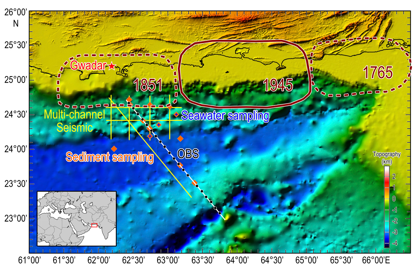
From 10 January to 3 February, Professor Yang participated in the first China-Pakistan Joint Indian Ocean Expedition on the Shiyan 3 research vessel. The Chinese and Pakistani scientists carried out in-depth investigation on the possibility of future megathrust earthquakes and tsunamis in the Makran trench. The expedition was led by the South China Sea Institute of Oceanology of the Chinese Academy of Sciences and the Pakistan National Institute of Oceanography.

The Makran trench is the meeting point of the Arabian Plate, the Indian Plate and the Eurasian Plate. A subduction zone is formed when the Arabian Plate descends beneath the Eurasian Plate. Energy is accumulated when the tectonic plates are stuck. When the energy accumulates to a certain point, it would be released in the form of earthquake, which may cause significant seafloor uplift and trigger devastating tsunamis. In fact, some of the biggest earthquakes occurred on the shallow portions of the subduction zones.
In 1945, a magnitude 8.1 quake happening in the Makran trench triggered tsunamis which battered Iran, Pakistan, Oman and India. The catastrophe claimed around 4,000 lives. Last year, a magnitude 6.3 earthquake shook the area.
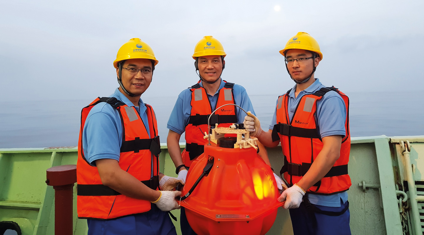
During the expedition, the scientists deployed 21 Ocean Bottom Seismographs (OBSs), state-of-the-art instruments that sink to the seafloor, to survey the seafloor surface and depth for the structure of the Earth’s crust. Professor Yang saw great value in the study: ‘The trench is unique in that it has a thick deposit of soft sediment. It used to be thought that soft sediment is not conducive to quakes but this is not true. The sample of sediment obtained and the analysis of the Earth’s crust could broaden scientists’ understanding of the quake mechanism in subduction zones. Even if no earthquake takes place, the presence of soft sediment can still trigger off tsunamis by marine landslide.’

The scanned images gave a clear picture of the distribution of sediment and should be a big help to scientists in evaluating the risks of tsunamis in that region in the future. Besides, data from the numerous small quakes in the region recorded by the OBSs will be used to delineate faults along which future earthquakes might occur.
Professor Yang, the only Hong Kong scientist on board, said he felt honoured to be part of the expedition team. Very few similar studies had been carried out in the region. ‘The study has great academic and strategic significance as Gwadar, a deep-water port situated near the oil production zones in the Middle East, is an important strategic and economic base on the China-Pakistan Economic Corridor under the Belt and Road Initiative,’ Professor Yang said.
This article was originally published in No. 516, Newsletter in Apr 2018.

