| |
| Back
Change Analysis: Uncovering the Space-Time Patterns of Land Use Change
The ecosystem, one of the most important systems for the survival of human beings, is continuously changing as a result of human activities. Such changes may present in different forms, such as rural-urban land conversion, land degradation, deforestation, biodiversity loss, and desertification. Central to these is probably land use/land cover change, which has significant economic and environmental impacts with implications for a wide variety of policy issues, including maintenance of water quality, preservation of open space, and mitigation of global climate change.
Under the umbrella of sustainable development and stimulated by the joint international efforts to reduce carbon emissions, detection, monitoring, modeling, and projection of land use change from global to regional scale have been given renewed emphasis within the community of Remote Sensing and GIS. Detecting and monitoring the change, however, is just the first step for sustainable planning and management. A further step is to identify factors that drive the change (e.g., land use change) and explore their relative importance, analyze the change pattern, understand the dynamic process of change, and simulate “what-if” decision making based on a variety of scenarios; that is, change analysis. Change analysis is a prerequisite to understanding the complexity of spatial change and forecasting the future trends of change patterns and their ecological impacts. Only after an effective change analysis can decision makers generate solutions to maintain the balance between ecology and the needs of ever-demanding population.
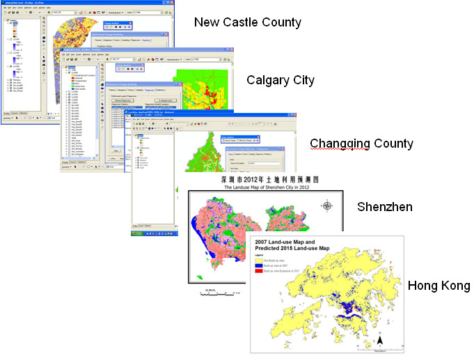
Under the support of the Hong Kong RGC/GRF, Prof Huang Bo and his research group have developed several spatial statistical and statistical learning models with consideration of spatial and temporal autocorrelations, data unbalance, and model robustness to support both the analysis and the forecast of future spatial distributions based on a limited set of times series land use maps. Based on these models, a registered software package, called ChangeAnalyst©, has also been developed for time-series panel-style change modeling with consideration of spatial autocorrelation by means of logistic regression. The software has been applied to many cities and regions for urban expansion and land use change analysis, which include New Castle county (US), Calgary city (Canada), Changqing county (China), Shenzhen (China), and Hong Kong. Prof Huang Bo has also edited a special issue of PE & RS on “Change Analysis” that has been published in August 2009, wherein the term was first coined and the subject has been addressed methodically. We believe that the Change Analysis methodologies and tools will find more applications in the campaign against global warming.
 |
|
|